


Planimeter Area Measure Guide

Planimeter Area Measure Guide介绍
(!) IMPORTANT: THIS IS A GUIDE for popular "Planimeter - GPS Area Measure" app (https://goo.gl/Yp0NLv).
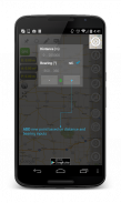
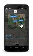
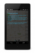
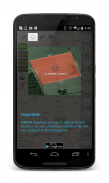
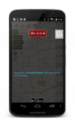
From this guide you can learn about Planimeter interface, functionality and main features before purchasing Planimeter. You can touch interface elements to get more details about their purpose and functionality. Don't hesitate to contact support@vistechprojects.com with any questions or if you need further assistance with Planimeter.
This guide presented in English, Russian, Portuguese and German.
Info about the Planimeeter app:
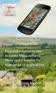
"Planimeter - GPS Area Measure" - Android application for all kinds of measurements on Google Maps.
It allows you to perform quick area, distance, perimeter and angle measurements on maps using different input sources. You can perform measurement by touching the screen; adding way-points with geo-coordinates (latitude and longitude); drawing on the map; using GPS tracking; dropping pins with exact distance and bearing from the last point.
The Planimeter app can be used in many areas and applications where measurement on land are required:
- outdoor activities: sports, golf (distance between two points or holes), bike tours, trail planning, travelling, quick measure
- garden and yard: landscape planning, grass cutting, lawn mowing, fencing, grass seeding.
- agriculture and farming: harvesting, fertilizing, crops (corn, wheat, maize, beet, etc.) planning and estimation, crop fields labeling for the records, field area measure, paddocks and area fencing for cows, horses, chickens, rabbits, etc.
- solar energy: area estimation for solar panels, flat roof area estimation
- construction: land survey, road sealing, parking lot repairing
- forestry: objects and tree mapping, damage area estimation
- other: ponds size and are measure; pole lines planning; directions and navigation to the marked / shared point; movement tracking; get exact GPS coordinates of way-points; fence calculation; measure distance on google maps
You can buy Planimeter - GPS Area Measure and read users feedback here: https://goo.gl/Yp0NLv
More about Planimeter - GPS Area Measure, tips and updates: http://goo.gl/IPF0NI
重要(!):这是一个流行指南“求积仪 - GPS面积测量”应用程序(https://goo.gl/Yp0NLv)。
从这个指南,你可以了解求积仪接口,功能及购买前求积仪主要特点。你可以触摸的界面元素,以获取有关其目的和功能的详细信息。不要犹豫,联系support@vistechprojects.com有任何疑问或如果您需要求积仪进一步的援助。
本指南中的英语,俄语,葡萄牙语和德语介绍。
有关Planimeeter应用信息:
“求积仪 - GPS面积测量” - 各种对谷歌地图的测量Android应用程序。
它可以让你使用不同的输入源的地图进行快速面积,距离,周长和角度测量。您可以通过触摸屏幕进行测量;加入方式点用地理坐标(经度和纬度);在地图上绘制;利用GPS跟踪;丢弃与从上次点精确距离和方位销。
该求积仪应用程序可以在需要的土地测量许多领域和应用程序中使用:
- 户外活动:运动,高尔夫,自行车旅行,足迹规划,旅游,快速测量(两个点或孔之间的距离)
- 花园和院子:景观规划,割草,修剪草坪,围栏,种草。
- 农业和农业:收割,施肥,作物(玉米,小麦,玉米,甜菜等)的规划和估算,农田标签的纪录,场区的措施,牧场和地区击剑牛,马,鸡,兔,等等
- 太阳能:太阳能电池板面积估计,平屋顶面积估计
- 建设:土地调查,道路封闭,停车场修理
- 林业:对象和树映射,损伤面积估算
- 其他:池塘大小,而且措施;极线规划;路线和导航标记/共享点;运动跟踪;获得方式点精确的GPS坐标;栅栏计算;衡量谷歌地图的距离
你可以买求积仪 - GPS面积测量,并在这里阅读用户的反馈:https://goo.gl/Yp0NLv
更多关于求积仪 - GPS面积测量,技巧和更新:http://goo.gl/IPF0NI


